Sea and littoral campaign
Discover the different sea campaigns in which our team has participated.
Hydro-morpho-sedimentary study of Anse de Banastère from November 16th to November 30th
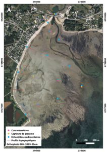
The objective of this campaign was to characterize the hydro-morpho-sedimentary features of Anse de Banastère. As part of a collaboration agreement between GMVA and the University of South Brittany, the laboratory deployed various measuring instruments, including an aquapro, an ADCP, and pressure sensors, conducted photogrammetric surveys by drone, collected sediment samples, and performed topographic measurements using DGPS. This mission aimed to enhance the understanding of the site.
GEOSTBRIEUC-2-MAPFC from April 29th to May 11th
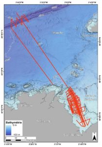
The Bay of Saint-Brieuc, also known as the Bay of Armor, presents a particular morphology stretching over 800 km2 between the Bréhat archipelago and Cape Fréhel. This coastal area bordering the English Channel features a complex and diverse coastline alternating between rocky shores, secluded beaches, and vast sandy-muddy expanses where numerous socio-economic activities at the land-sea interface are developed. The current geomorphological context of the bay is part of a tectonic and climatic legacy spanning several million years, where sedimentary episodes from the late Cenozoic period recorded by Plio-Quaternary cliffs coexist with present coastal systems.
The objective of this campaign is to continue and complete the study on the construction dynamics (diachronic analysis) of the Holocene sediment prism of the Bay of Saint-Brieuc within a land-sea continuum framework, using high-resolution seismic data, bathymetric data, and digital terrain models (current and fossil) to develop a land-sea sediment dynamics model for the Holocene period.
DOI : http://dx.doi.org/10.17600/18002044
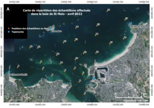
Study of hydro-sedimentary dynamics in the Bay of Saint-Malo from March to April
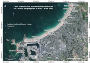
This study was conducted in two separate samplings: a sampling of the foreshore and a sampling of the bay. We collected a total of 24 samples in March 2022 from the intertidal zone of the beaches in the city of Saint-Malo, particularly from the foreshores of the following beaches: Môle, Bon-Secours, Éventail, Sillon, Hoguette, Rochebonne, Mihinic, and Pont. Then, in April 2022, we took 25 samples from the subtidal part of the Bay of Saint-Malo, using the Orange Peel grab sampler.
Analysis, study and conceptual modeling of the silting of the Saint-Cado Channel from June 3rd to June 12th
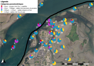
In order to answer the questions of boat owners, shellfish farmers and elected officials, the Syndicat Mixte of the Etel Ria hired the LGO-UBS to carry out a study to characterize the silting of the northeast sector of the channel of Saint-Cado (Belz), its economic, social and environmental consequences, and identify solutions to fix this situation.
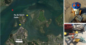
To achieve these objectives, a sedimentary characterization of the study site was conducted. This involved collecting 34 geolocated samples taken by hand and using a grab sampler. Subsequently, a characterization of the hydrodynamics of the area was carried out using probes from June 3rd to June 12th, 2019.
As part of the GHYSMO Project - Morpho-hydro-sedimentary Study from June 14th to June 21st
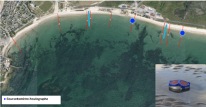
In order to gain a comprehensive understanding of the dynamics of Grande-Plage de Gâvres and to formulate recommendations for its rehabilitation, two one-week measurement campaigns were conducted.
During this second campaign, a wave current meter was deployed, and the survey of 9 profiles per day was conducted.
As part of the GHYSMO Project - Morpho-hydro-sedimentary Study from October 20th to October 26th
In order to gain a comprehensive understanding of the dynamics of Grande-Plage de Gâvres and to formulate recommendations for its rehabilitation, two one-week measurement campaigns were conducted.
During the first campaign, we deployed 5 measuring devices, surveyed 9 profiles per day, and collected 12 sediment samples per day.
